Selsey Pavilion

NEWS 08/04/2024

GEOTEC Case Study Background

Selsey Pavilion is an art deco, 110-year-old theatre, in the seaside town of Selsey, West Sussex. 

On 27th February 2024, the Selsey Pavilion Trust (SPT) acquired Selsey Pavilion; a huge accomplishment and milestone for SPT and 7 years in the making, 50 years after its closure.

The aim of the SPT is to “ensure Selsey Pavilion’s long-term future as a multi-purpose arts and heritage centre for the whole of Selsey’s community and visitors to enjoy”.

In the first phase, the SPT has plans to make the building safe and secure to enable public access, but in tangent the Trust is working on RIBA Stage Two plans for a full restoration of the iconic local landmark as a community arts and heritage centre.

Underground Mapping for Selsey Pavilion

Selsey Pavilion (front elevation)

The purchase process involved SPT having to meet the various requirements of the organisations and national funding bodies that would offer the financial support, to allow the purchase to take place.

This financial support came from the Government’s Community Ownership Fund, The National Lottery Heritage Fund, Garfield Weston Foundation, Swire Group, Selsey Town Council, Chichester District Council, and the Architectural Heritage Fund.

As part of this progression, GEOTEC Surveys Ltd were approached by Christian Skelton, Chair of SPT, to complete an Underground Utility Mapping, Ground Penetrating Radar (GPR) and Topographical Survey of the site.

There were 2x primary concerns that SPT needed to gain clarity:

  1. The location and depths of the electrical services coming from the adjacent substation building and running in the road adjacent to the Selsey Pavilion.
  1. Whether there was any evidence of the presence of a former cesspit within the same area.

OPERATIONS

A 3-person survey team attended the site on Thursday 25th May 2023 to complete the survey, which related to the adjacent roadway and a section to the rear of the existing property as shown below in red and purple:

Underground Utility Mapping & GPR Survey

SURVEY AREAS (RED & PURPLE)

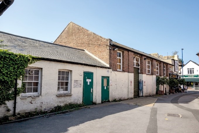
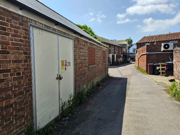
Our team were able to enter the substation using specially trained survey staff, with permission from the substation owner.

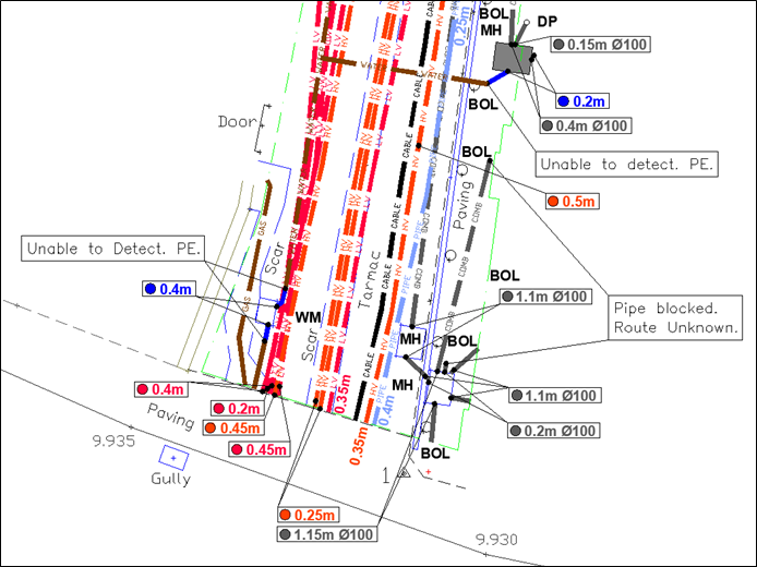
From the substation, our team directly traced the electricity cables out, into the survey area, which delivered a key objective of the survey. This was completed using active signal induction through radio frequency detection (EML).

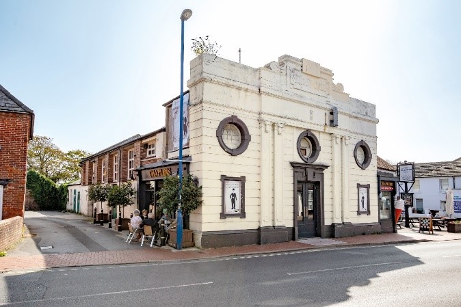
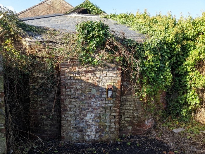
Our surveyors were also able to gain access inside the building so that they could establish incoming service points and the location of the toilets and associated drainage.

In addition, our team was met by the then-owner who was able to provide information as to the location of the water.

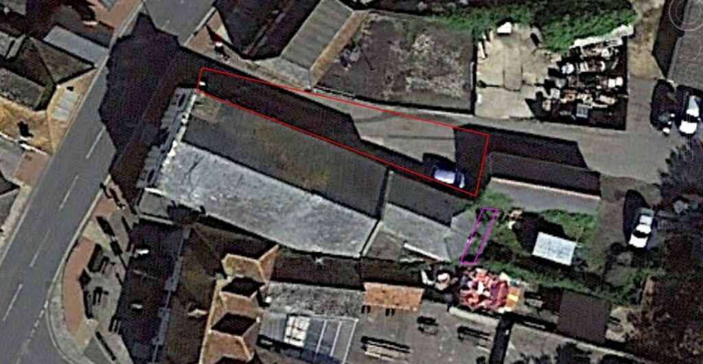
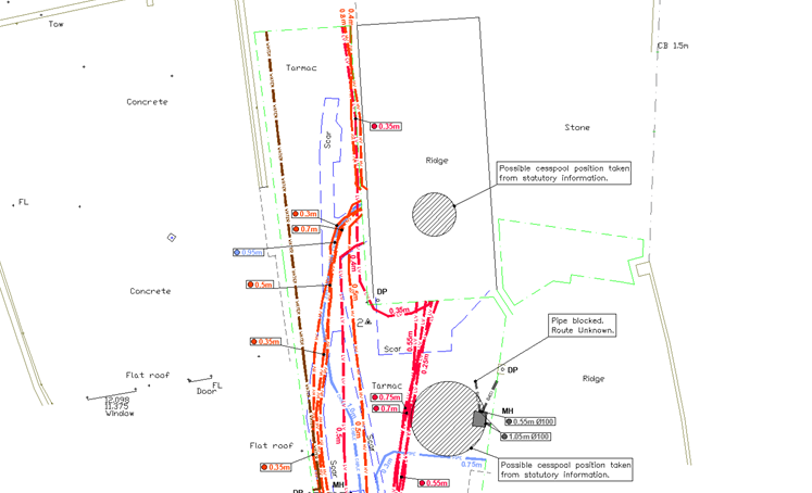
The team also surveyed the site thoroughly using a Ground Penetrating Radar (GPR) system in an attempt to identify evidence in changes of ground density relating to the possible location of a former cesspit, which has been plotted onto the survey results using previous drawing information from an old hand-drawn site plan.

Results

Our lead surveyor and CAD technician overlaid our survey results onto the Topographical Survey received from SPT.

This shows the volume of electrical services exiting the substation as well as the possible location of the former cesspit.  This also indicates where drainage channels were found to be blocked and the assumed route of the water.  No services were detected within the area to the rear of the building.

Example of underground survey

Extract of GEOTEC Survey Results (substation end)

This below extract shows the volume of electrical services exiting the road, into the High Street, from the substation further down as well as the assumed positions of the incoming gas and water. 

Example of underground gpr survey

Extract of GEOTEC Survey Results (High Street End)

The survey found that the road adjacent to Selsey Pavilion has a high congestion of buried services and utilities, predominantly associated with the neighbouring substation.

These results signify the importance of being able to directly and accuratley trace these services out the substation and will benefit the SPT’s long term planning for possible future extensions or alterations to the building.

London Borough Lambeth

GEOTEC Surveys worked with London Borough of Lambeth to provide a PAS128 Underground Utility Mapping and GPR Survey outside Waterloo Station to support the design of a footway buildout and installation of a Copenhagen style crossing in Mepham Street.

Portsmouth Water

GEOTEC Surveys supported Portsmouth Water in providing a 3D PAS 128 Underground Mapping & GPR Survey for the proposed reservoir pipeline route over 3.8km in 2020.

Pembrokeshire County Council

GEOTEC Surveys Ltd completed 2x comprehensive PAS 128 Surveys over the February Half Term and Easter Holiday Period at Haverfordwest High School & Milford Haven Secondary School in Pembrokeshire.

Case Studies

FURTHER READING

For an in-depth review of Geotecs most recent underground mapping projects see the case studies that are featured throughout the website.

Alternatively please click the link below to explore the resources section.

Request a survey