
EM31 CMD Electromagnetic Conductivity
EM31 CMD Electromagnetic Conductivity
Detecting anything from fine, shallow details to larger structures hidden far below.
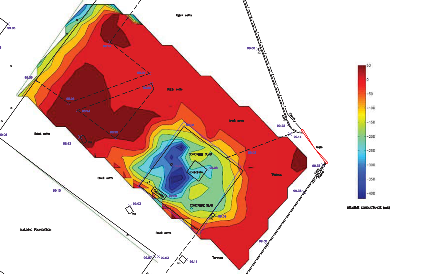
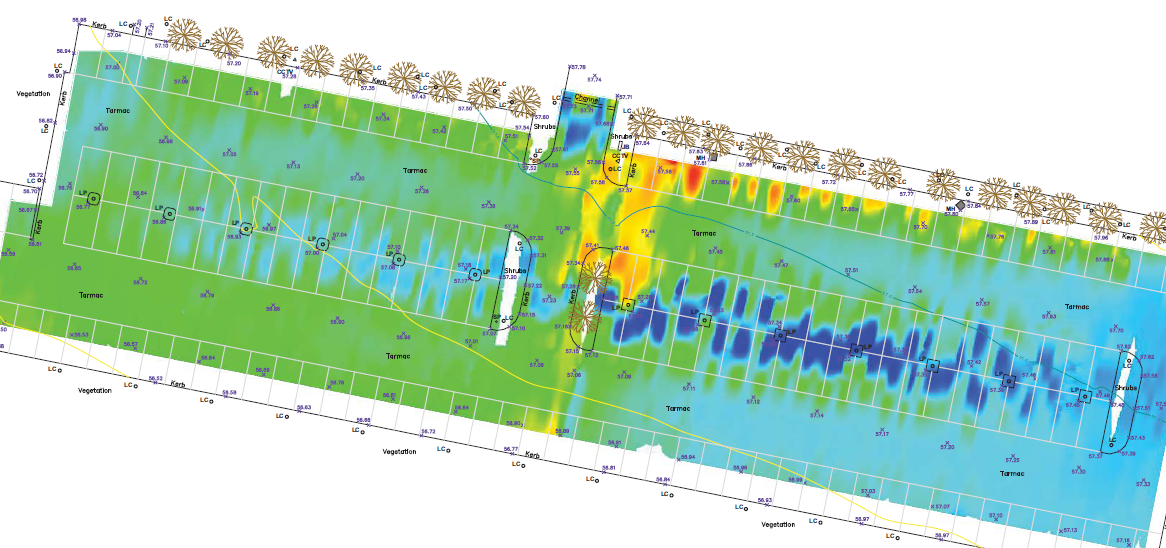
These tools map geological variations, groundwater contaminants or other sub-surface features associated with ground conductivity; using an electro-magnetic inductive technique that makes the measurements without electrodes or ground contact.
Typical features which can be located are:
- Mine shafts, coal shafts and buried wells
- Old foundations/ building lines, footings and pile caps
- Basements & cellars
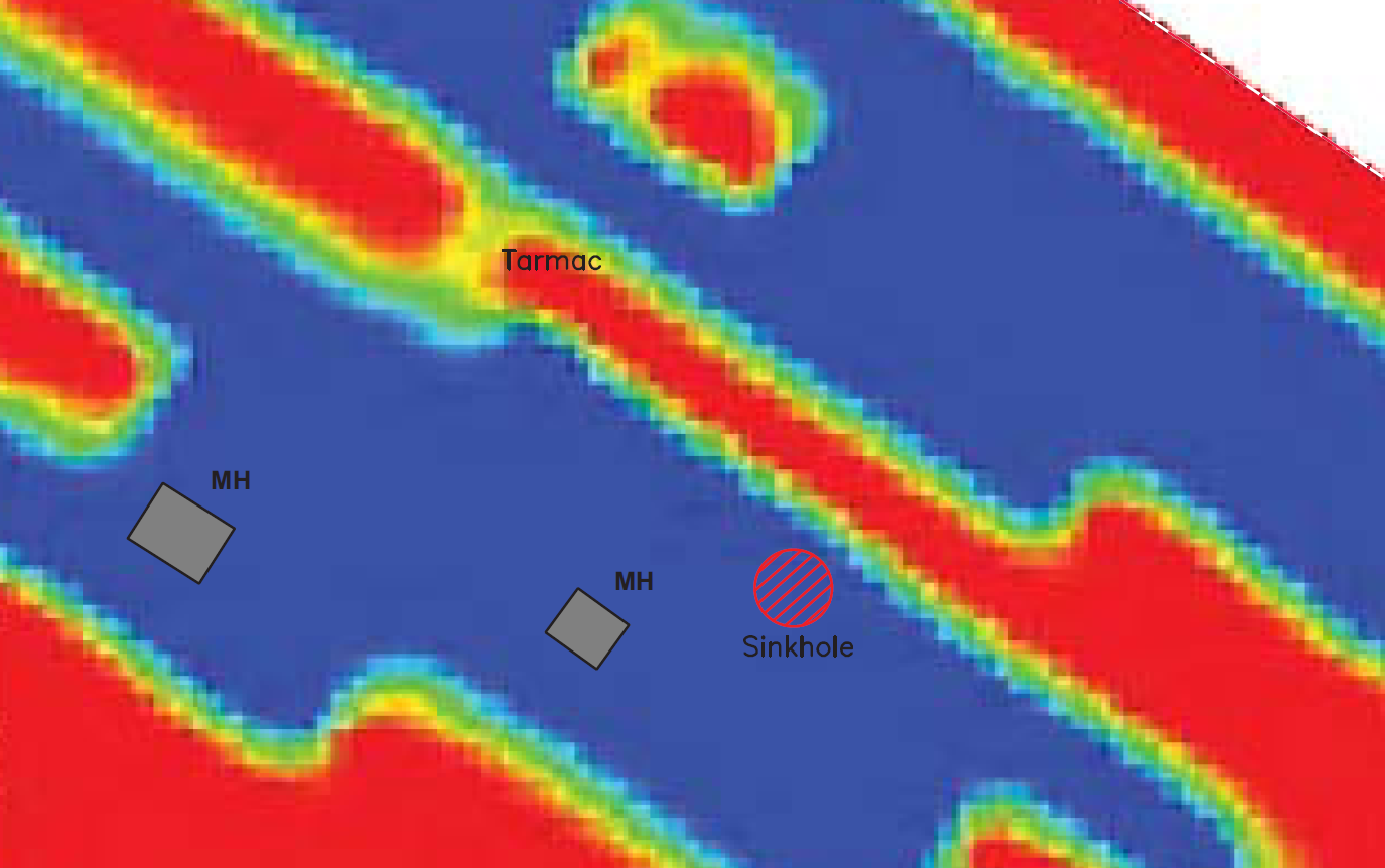
- Tunnels, cavities, sink holes and underground voids,
- Dissolution features
- Buried tanks & other structures
- Bedrock and ground water
Want to know more about EM31 CMD?
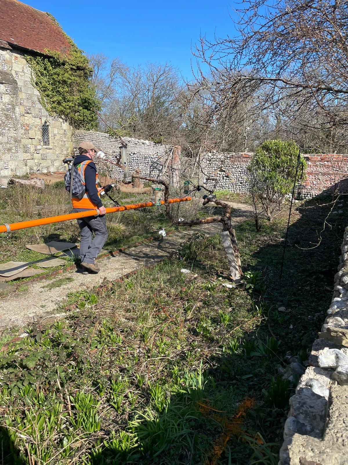
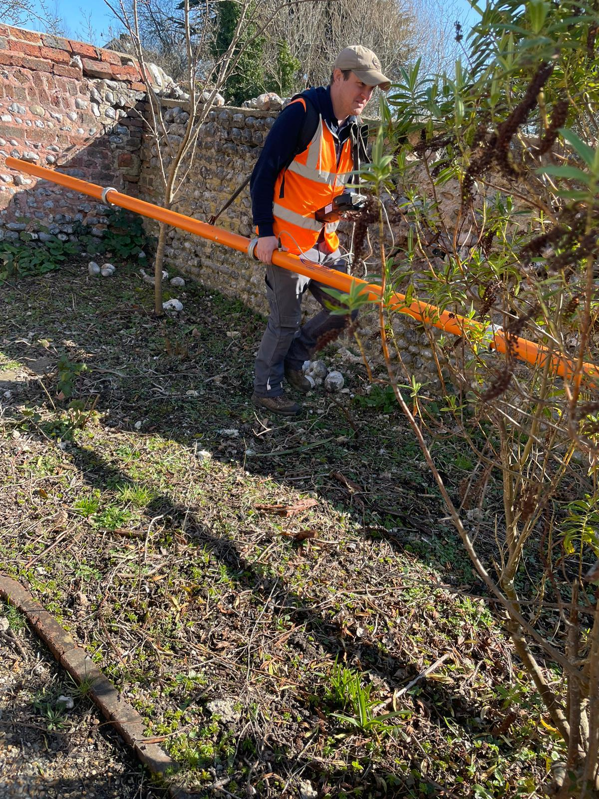
The EM31 has a depth penetration of 6m below the ground surface, whilst the CMD Explorer can achieve 3x different depth penetration thresholds; up to 2.3m, up to 4.2m and up to 6.7m respectively (subject to site conditions).
The equipment is designed to precisely detect small changes in the sub-surface conductivity and has proven a useful tool for the detection of buried metallic structure and waste, as well as mineshafts or wells.
Disadvantages are that the data collected is adversely affected by the presence of metallic objects, whilst it is not possible to apply a depth to any anomalous areas highlighted.
Both tools are particularly good at achieving data collection across larger areas over a shorter time frame than other methods.
Below are some example survey results illustrating what the equipment can achieve.
Underground
Mapping
This tool also allows us to confirm the presence of metallic and conductive services that have already been detected through radio frequency detection / electro-magnetic locating (RFD / EML).
GPR Surveys
ERT / Resistivity
Talk to Geotec


Follow Online
© GEOTEC SURVEYS – UNDERGROUND MAPPING


Website designed and produced by expect more – part of snap-marketing.co.uk
Website designed and produced by
expect-more.co.uk