
3D Underground Mapping
3D Underground Mapping
Providing survey results in 3D AutoCAD DWG format for buried services & utility mapping surveys, as well as those in line with PAS 128.
GEOTEC Surveys also provide survey results in 3D AutoCAD DWG format for buried services & utility mapping surveys, as well as those in line with PAS 128.
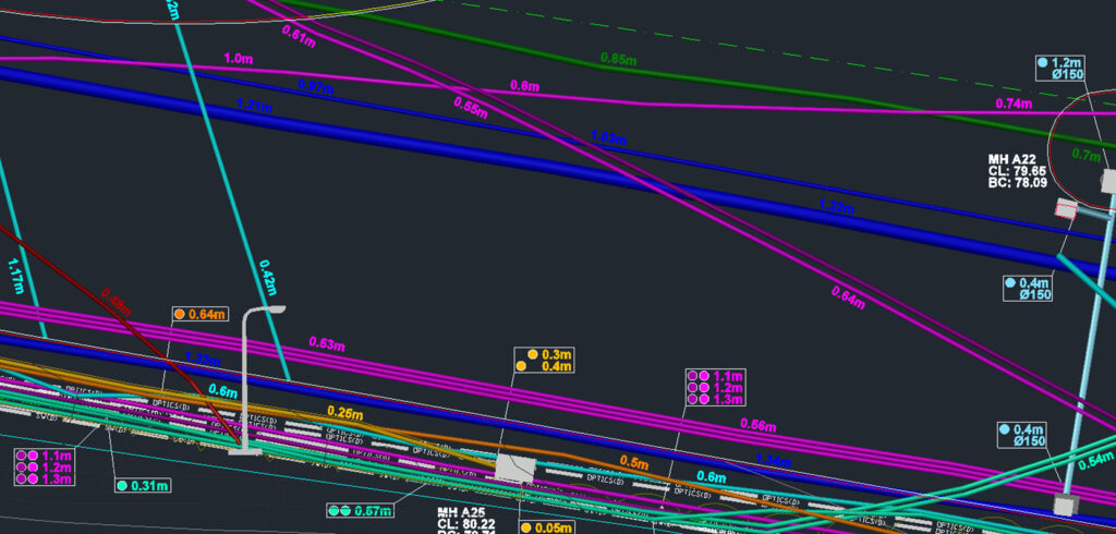
This is achieved through precisely understanding the positions, depth and sizes of the services which are visible within their corresponding manhole or inspection chamber, which are topographically recorded using a Total Station.
Their routes are surveyed using radio frequency detection AND Ground Penetrating Radar (GPR) on a suitably tight orthogonal grid, so that the depths can be evaluated in line with the ground level (z).
The 3D outputs identified below have predominantly been produced using a multi-array GPR system and post processed in special software to allow a 3D representation to be produced.
Want to know more about 3D Underground Mapping?
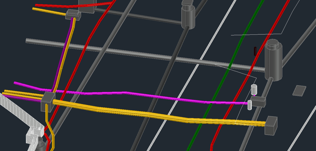
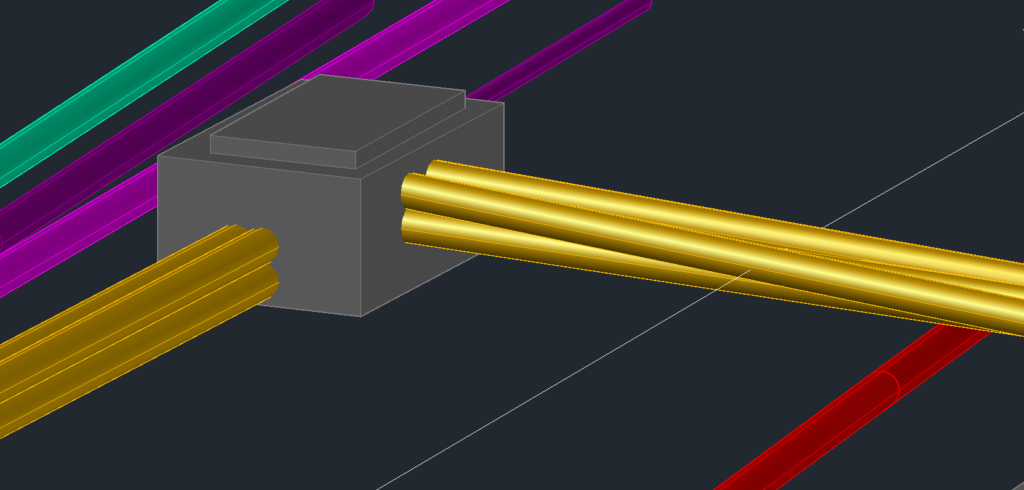
Examples of rendered 3D buried services survey results
The detection of buried services & utilities is conducted using the same standards, techniques & methods used for our 2D surveys, including GPR & EML; however additional data is collected in order to provide a 3D representation.
Underground
Mapping
An example of a survey where Geotec have several unidentified ground penetrating radar targets present, as well as confirmed buried services and utilities.
This tool also allows Geotec to confirm the presence of metallic and conductive services that have already been detected through radio frequency detection / electro-magnetic locating (RFD / EML).
2D Topographical Surveys
3D Topographical Surveys
3D Laser Scanning
Talk to Geotec


Follow Online
© GEOTEC SURVEYS – UNDERGROUND MAPPING


Website designed and produced by expect more – part of snap-marketing.co.uk
Website designed and produced by
expect-more.co.uk