
Desktop Utility Studies
Desktop Utility Studies
Taking away the headache of approaching countless utility providers and understanding
near-illegible records in a variety of formats and scales.
A PAS 128 Type D desktop study offers a one stop shop, providing a cost effective, clear and concise combined utility plan of your site.
Geotec procure & collates utility asset records onto a single drawing, overlaying them onto background mapping data, as different layers, so that you can navigate between services, with results provided in DWG & PDF formats.
This service takes away the headache of approaching countless utility providers and understanding near-illegible records in a variety of formats and scales. The CAD Technicians are also utility mapping surveyors and can draw on their experience to interpret these records and plot them in line with how particular services are likely to be positioned in real life.
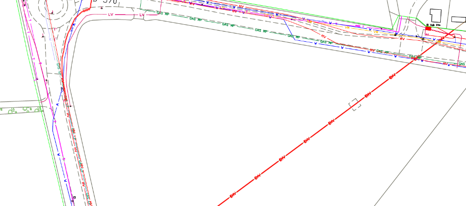
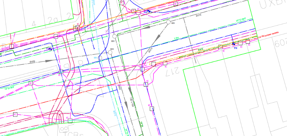
(PAS 128 TYPE D)
This information provides an invaluable resource which informs at the early stage of a development, before substantial costs are incurred.
Geotec have assisted many clients by obtaining statutory undertakers records “Stats” and collate these onto background data for various projects:
- Large wind / solar farm developments
- Cable route installations
- Feasibility studies for urban/rural developments – large or small
Request a survey
A Desktop Utility Study involves obtaining existing record data for each type of service—including power, water, gas, drainage and telecommunications—from the relevant asset owners, such as Thames Water, UK Power Networks, Openreach and Cadent.
GEOTEC then collates the records and plots them onto a procured base plan, providing the client with one combined drawing showing the mains-record information received for the site or search area.
A PAS 128 Type D desktop study includes:
- A summary of the utility providers approached and whether they have indicated infrastructure within the search area.
- The original records supplied by the utility providers.
- An AutoCAD DWG file showing relevant records on a combined base plan.
- A PDF version of the combined plan.
A Desktop Utility Study is useful during the feasibility stage to understand which services may cross a proposed development site.
It is also a prerequisite for a PAS 128 utility mapping survey, where the records guide the survey team during the physical detection of services across the survey area (Type B).
Whenever there is uncertainty about possible buried or overhead services, asset records provide a useful starting point. They can also help determine survey feasibility, identify access points such as manholes, define the survey area and indicate likely service depths so that the appropriate equipment can be selected.
No. A utility survey physically detects buried services and utilities onsite.
A Desktop Utility Study collates the existing service information available from multiple sources into a combined drawing. These records may be limited to mains services and often do not extend inside private boundaries.
A Desktop Utility Study establishes the starting point for a project and helps determine how future onsite surveys should be specified.
It can help assess whether existing services require diversion, whether the current infrastructure has sufficient capacity and where proposed infrastructure could connect to existing networks.
The study can also identify services affected by development proposals, the organisations that need to be consulted, and possible easements, access rights or other constraints.
All projects involving potential buried or overhead services should begin by obtaining existing record information. This provides a reliable basis from which feasibility work, design decisions and subsequent onsite surveys can progress.
Underground
Mapping
An example of a survey where Geotec have several unidentified ground penetrating radar targets present, as well as confirmed buried services and utilities.
This tool also allows Geotec to confirm the presence of metallic and conductive services that have already been detected through radio frequency detection / electro-magnetic locating (RFD / EML).
PAS 128 Surveys
GPR Surveys
Vehicle Mounted GPR Surveys
Utility Mapping / Buried Services Surveys
Service Clearance / Marking Out Surveys
Talk to Geotec



Follow Online
© GEOTEC SURVEYS – UNDERGROUND MAPPING







Website Design & Development Hampshire – expect-more-creative.co.uk