The Dock Feeder and Cardiff City Centre East Scheme has won a major Civil Engineering accolade; The 2024 Bill Ward Sustainability Award.
GEOTEC Surveys completed the PAS128 Utility Mapping and GPR Survey works as part of this scheme in 2019 and 2020.
The overall survey works were completed in 4 Phases:
- Phase 1: Stuttgarter Strasse, Park Place, Dumfries Place and Station Terrace.
- Phase 2: Station Terrace, Guildford Street, Guildford Crescent, North Edward Street and Churchill Way.
- Phase 3: North Street and Boulevard De Nantes.
- Phase 4: Newport Road and Fitzalan Road.
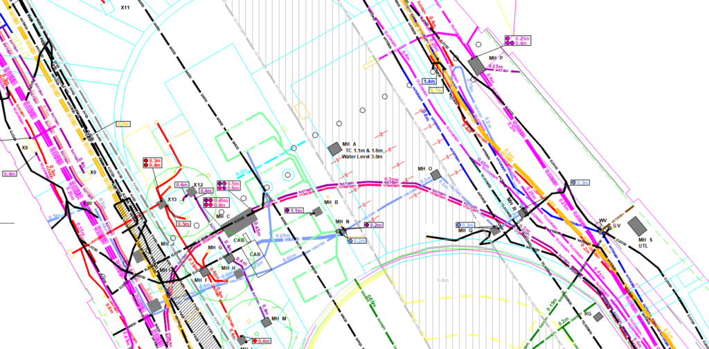
As part of this, we uncovered a number of access points and manholes relating to the canal which was found to be running underneath Churchill Way (Phase 2). An extract of our GPR survey results are shown below showing this.

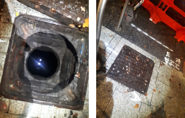
The above extract of Churchill Way shows Manhole A and the Culvert (grey hatching) that was discovered. The Water level is 3m below the ground. The below photo shows the inside of Manhole A& the manhole cover that was investigated.

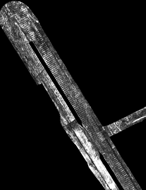
As part of this survey we also carried out a vehicle mounted Ground Penetrating Radar (GPR) survey and the below extract is an example of the data return received back. This clearly shows the concrete beams that were used to seal up the canal, which were removed during the restoration.

The Canal was hidden for 70 years and since our survey was completed in 2020, has now been reopened, a process which took around 2 years.
GEOTEC are proud that our surveys, at the very beginning of the scheme, has seen the Project win a major award.
We believe that our PAS128 Utility Mapping, GPR and Topographical Surveys are pivotal to ensuring that schemes and projects such as this get off to the best possible start.

 +44 (0)1428 686 168
 enq@geotecsurveys.com


