
Geophysical GPR Surveys
Ground Penetrating Radar (GPR) is a versatile tool which can be used to meet a range of objectives:
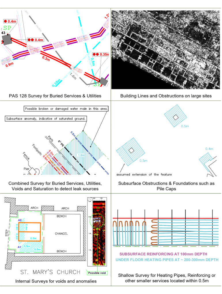
- Buried services and utilities, in particular drainage, culverts and plastic pipes
- Changes in density relating to voiding or unconsolidated ground.
- The presence of subsurface features such as obstructions, tanks, pile caps and building lines
- Saturated ground conditions and wash associated with leaks
- Graves, crypts, tombs, basements and cellars
- Reinforcing and rebar in concrete slabs and concrete thicknesses
We use a range of GPR antennae in order to search for features at a variety of depths in order to best meet your needs
- Handheld GPR system 0-450mm (below ground level)
- Shallow antenna 0-1m
- Standard antenna 0.1-3m
- Deeper antenna 2-10m
- Dual frequency antenna
Want to know more about Geophysical GPR Surveys?
We also use GPR when carrying out PAS 128 and buried services / utility mapping surveys as a matter of course, examples below:
Underground
Mapping
An example of a survey where we have several unidentified ground penetrating radar targets present, as well as confirmed buried services and utilities.
This tool also allows us to confirm the presence of metallic and conductive services that have already been detected through radio frequency detection / electro-magnetic locating (RFD / EML).
Electromagnetic Surveys
ERT / Resistivity
Talk to Geotec


Follow Online
© GEOTEC SURVEYS – UNDERGROUND MAPPING


Website designed and produced by expect more – part of snap-marketing.co.uk